Late Cretaceous Earth - maps and 3D model (Maastrichtian age)
Full resolution variant of these maps will be available for purchase as posters on my Redbubble page, and as uncompressed digital files on my Patreon store. The raw files measure at least 100 cm on one axis, 300 DPI.
You can find the links here: https://linktr.ee/carlaugustw
Brief behind the scenes:
This paleo-geographic series took roughly 4 months to make, using Photoshop, Blender and Illustrator for the visuals. Other softwares like Gplates, ArcGIS and Gprojector were used for data management, map projection, and extracting grid for map layout etc.
The main plate tectonic placement is a hybrid of different Gplates models from Earthbyte, including Cao et al. 2024 and Scotese 2024. Fossil data from the Paleobiology database was also overlayed to sketch some environmental settings in ArcGIS. A long list of references and papers were used as inspiration for certain regions, such as 'Paleotectonic reconstruction of the central tethyan realm' (2018) for western Asia and eastern Europe. I will try and provide the full list in the future if it is requested.
The basemap for the reconstruction was made in 60K x 20K resolution (roughly 0.6 km per pixel). This basemap includes several layers, such as albedo-map, heightmap and seamask. The heighmap was made using custom brushes in Photoshop, then thrown into a simple erosion simulator, and later rendered in Blender for shaded relief.
I will eventually make 20K x 10K (2km per pixel) variant of the basemap available as well, which can be used for 3D projects and your own custom map layouts.
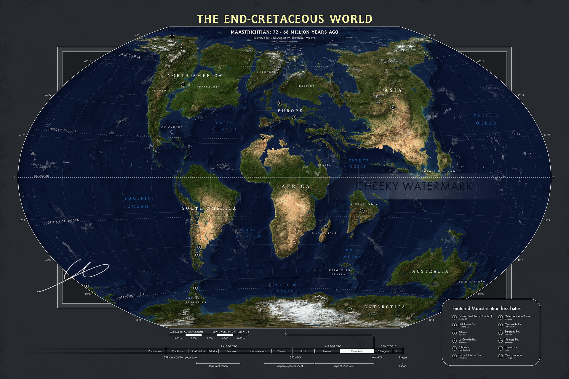
General Map of the World

World Topography
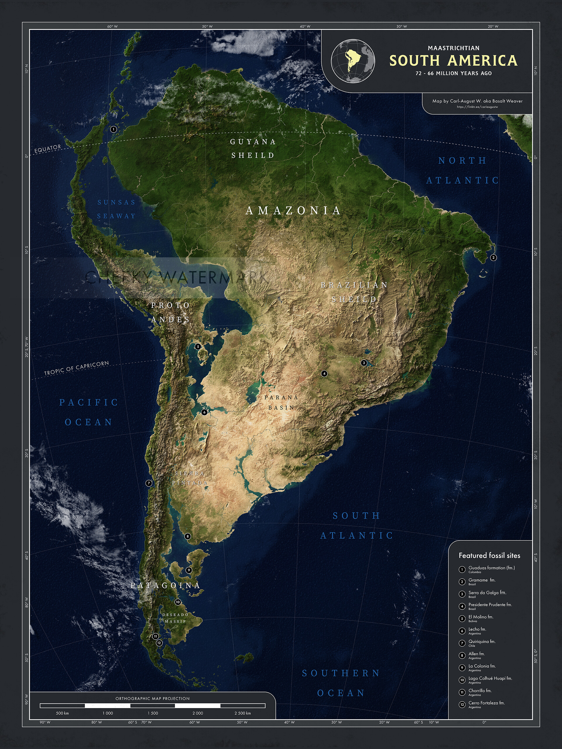
South America

East Gondwana

Africa

Europe
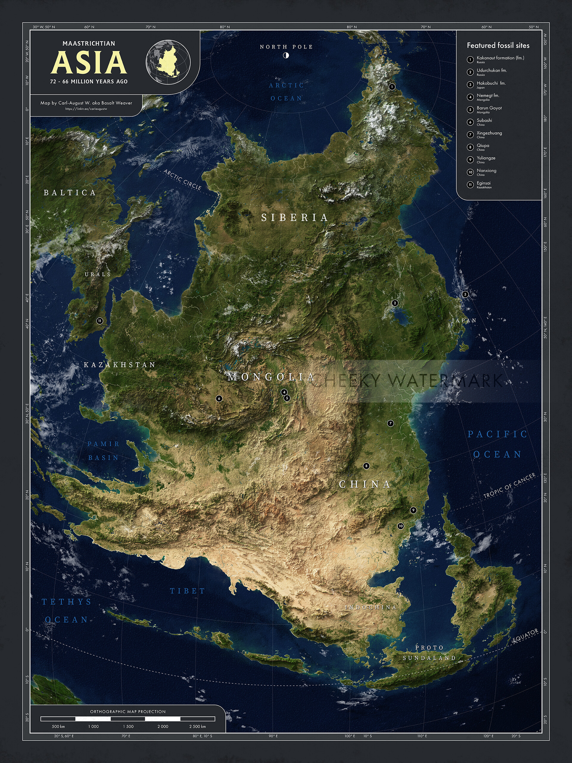
Asia
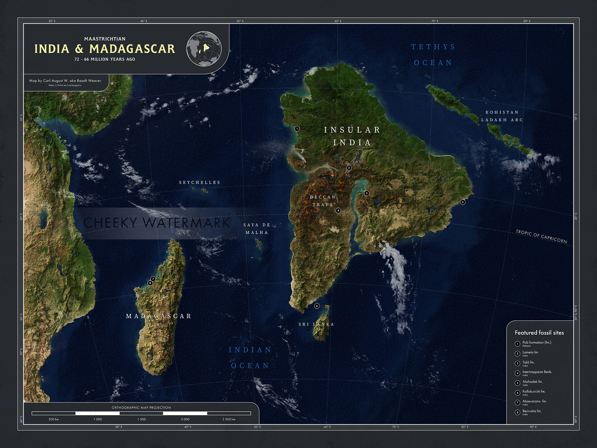
India and Madagascar
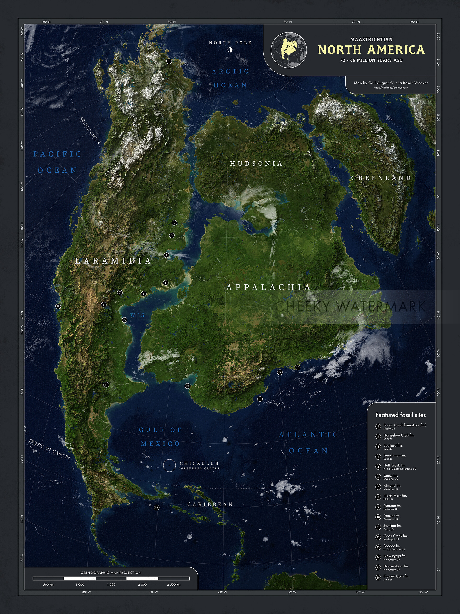
North America

Danian Gulf of Mexico (post asteroid impact)


